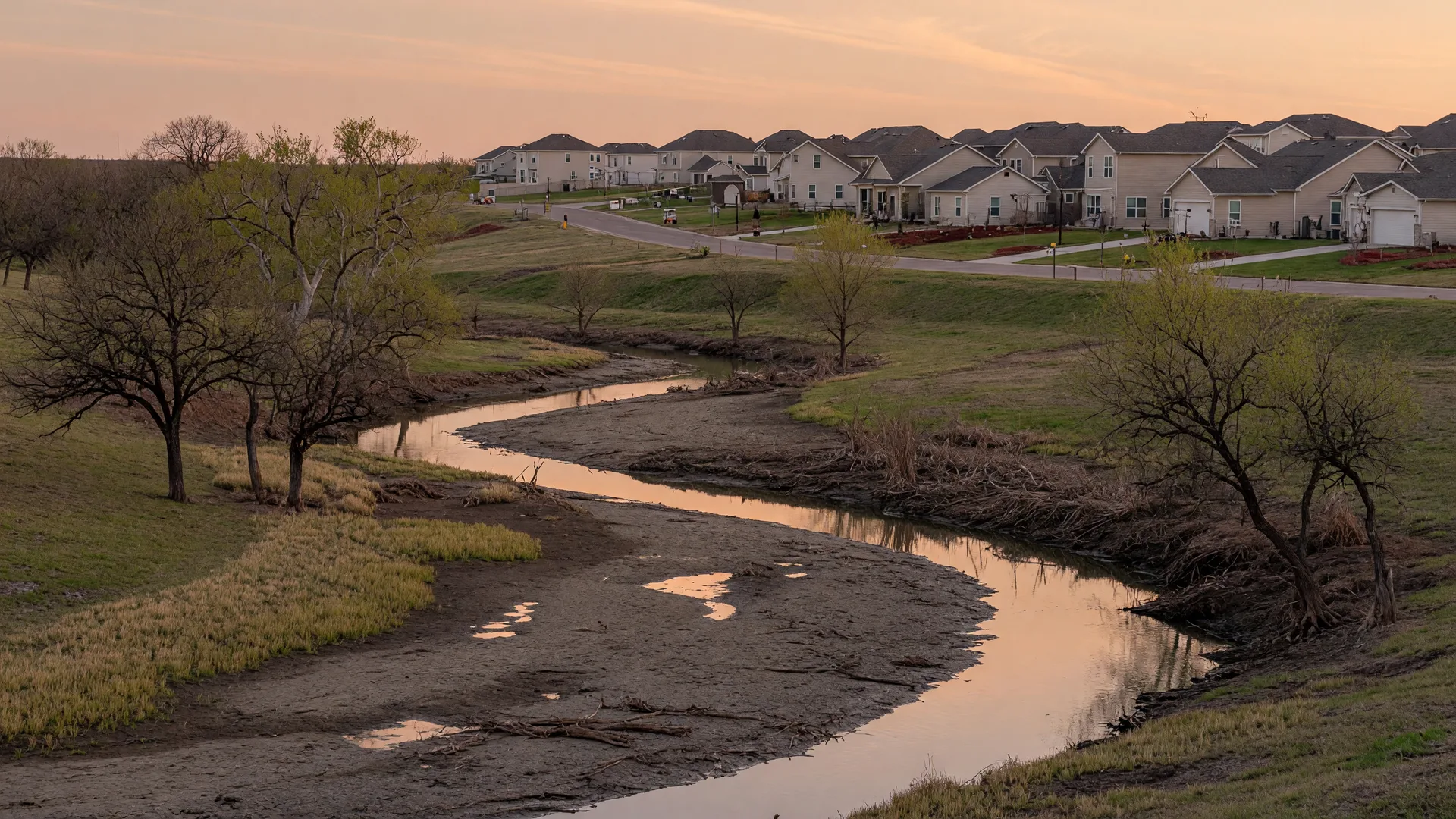
Flood risk is a property-specific fact, not a neighborhood rumor. Two homes a street apart can sit on different sides of a mapped flood boundary, and the maps themselves are updated over time, so the only reliable way to know a property's flood risk is to check the official sources for that exact address. This article gives you the five official checks I walk buyers through before they offer: the FEMA flood map, the seller's disclosure, USGS stream and flood data, Texas Water Development Board flood-planning tools, and the county floodplain map, plus what flood insurance requirements mean for a home in a mapped flood zone.
Quick Answers
These are the short answers; the sections below show exactly how to verify each one for a specific property.
- How do I check if a Denton County property is in a flood zone? Start with FEMA's Flood Map Service Center address search and the National Flood Hazard Layer, then read the TREC Seller's Disclosure Notice (Form 55-1), and confirm with the Denton County floodplain map. All three are free official sources.
- What does Special Flood Hazard Area (SFHA) mean? FEMA defines an SFHA as an area with a 1% or higher annual chance of flooding on its flood maps. Flood insurance is required before closing when the home sits in a mapped SFHA and the loan comes from a federally regulated or insured lender.
- Can a home outside a FEMA high-risk flood zone still flood? Yes. FEMA maps show mapped flood hazards, not the complete risk picture. Drainage problems, localized stormwater flooding, and flooding outside mapped high-risk areas can still occur, and the maps themselves are updated over time.
- Can a newly built home still have flood or drainage risk? Yes. Builders grade and sometimes raise lots, but the effective flood map may not reflect the finished grade, and drainage issues can occur on new lots. Verify the map, the builder's grading and drainage plans, and the recorded flood history before you close.
- What flood questions does the Texas Seller's Disclosure Notice ask? Under Texas Property Code Section 5.008, the seller must complete the Seller's Disclosure Notice (TREC Form 55-1) and disclose whether the property is in a 100-year floodplain or floodway, whether it has ever flooded, whether it has flood insurance, and whether it has flooded from a reservoir breach or a controlled release of water.
- Are the flood maps changing in Denton County? FEMA announced on June 1, 2026, that preliminary flood maps for portions of Denton County were ready for public view, and the announcement brings a 90-day appeal and comment period with dates stated in FEMA's press release. As of this article's review, whether that appeal window is currently open or has closed could not be verified, so check FEMA's June 1, 2026 press release and confirm the current status with the applicable floodplain administrator before relying on any deadline.
- Is flood insurance required for every home in Denton County? No. It is federally required when a home sits in a mapped Special Flood Hazard Area and the loan comes from a federally regulated or insured lender. Outside a mapped high-risk area, a lender can still require flood insurance as a condition of the loan, and FEMA notes there is no “no-risk” zone.
- Does homeowners insurance cover flooding? No. Standard homeowners policies generally do not cover flood damage. Flood coverage is a separate NFIP or private flood policy, and the decision to carry it belongs with you and your insurer.
Table of Contents
- Why Flood Risk Is Address-Specific in Denton County
- Step 1: FEMA Flood Map Service Center
- Step 2: The TREC Seller's Disclosure Notice
- Step 3: USGS Stream and Flood Data
- Step 4: Texas Water Development Board Tools
- Step 5: Denton County Floodplain Maps
- Preliminary Maps and the 90-Day Window
- Flood Insurance and the SFHA
- The Buyer's Flood-Risk Checklist
- Frequently Asked Questions
- Conclusion
- How I Can Help
- Primary Sources
Why Flood Risk Is Address-Specific in Denton County
Denton County's floodplains follow its creeks and rivers, including Denton Creek, Hickory Creek, and the Elm Fork of the Trinity River, and those boundaries are mapped parcel by parcel. A mapped floodplain can run through the middle of a neighborhood, put one side of a street in a high-risk zone and the other outside it, or cover part of a single lot. The mailing address, the community name, and the builder's brochure tell you none of this. Only the official map for the exact property tells you where the boundary actually falls.
New construction adds another layer. Builders grade and sometimes raise lots, and the effective flood map may not reflect the finished grade of a recently completed home. That is one reason the map check is a starting point, not the whole answer: for a serious purchase, you may also want a flood insurance quote and to check with the local floodplain administrator about local elevation and drainage requirements before you commit.
The checks below are the ones I use with buyers in Argyle, Northlake, Flower Mound, Justin, and the rest of Denton County. They are free, official, and address-based, and together they give you a clear picture of the property's flood risk before you write an offer.
Step 1: FEMA Flood Map Service Center
The FEMA Flood Map Service Center (MSC) is FEMA's official public source for flood hazard information produced in support of the National Flood Insurance Program (NFIP). Enter the property address and the MSC shows the Flood Insurance Rate Map (FIRM) zone for that location, and lets you print a FIRMette, a printable PDF map based on the National Flood Hazard Layer that includes any Letters of Map Revision for the area.
The National Flood Hazard Layer (NFHL) is the geospatial database of current effective flood hazard data, and the FEMA Flood Maps page explains how to read the maps. Areas with a 1% or higher annual chance of flooding are called Special Flood Hazard Areas (SFHAs) and are considered high risk. The map shows a flood zone letter for the property, such as an A or AE zone inside an SFHA or an X zone outside it. FEMA is explicit that there is no "no-risk" zone: the maps classify risk, they do not eliminate it.
What this check tells you: whether the property sits inside, partially inside, or outside the mapped high-risk area on the current effective map, and which flood zone applies. Save a copy of the FIRMette for the address, because it is the document lenders and insurers will reference. Keep in mind that FEMA maps show mapped flood hazards, not the complete risk picture for a property: drainage problems, localized stormwater flooding, and flooding outside mapped high-risk areas can still occur, and the maps are updated over time.
Step 2: The TREC Seller's Disclosure Notice (Form 55-1)
Texas Property Code Section 5.008 requires a seller to complete the Seller's Disclosure Notice (TREC Form 55-1) for a resale home. TREC released Form 55-1 in May 2026 as the current version of the notice, replacing the earlier OP-H (later 55-0) designation. The form's flood provisions ask the seller whether the property is located wholly or partly in a FEMA 100-year (SFHA) or 500-year floodplain, a floodway, a flood pool, or a reservoir; whether the seller has ever filed an NFIP flood damage claim; and whether the seller has received FEMA or SBA assistance for flood damage. Since Senate Bill 339 took effect September 1, 2019, the form also asks whether the property has previously flooded due to a failure or breach of a reservoir or a controlled or emergency release of water.
The disclosure is a statement from the seller, so treat it as a starting point and verify it against the official map and any other records. If the seller answers yes to any flood question, ask for details: when the flooding happened, how deep the water got, what was damaged, and what was repaired. For a new construction home, there is no seller disclosure in the same sense, which makes the map, the builder's grading plans, and the elevation certificate more important.
You can also confirm that the agent or broker you are working with holds a valid Texas license through the TREC License Holder Search. I am a Texas Real Estate Broker, License 807294, and a Florida Broker, License 3102580, with Covenant Heritage Realty, LLC.
Step 3: USGS Stream and Flood Data
The U.S. Geological Survey operates streamgages that measure real-time streamflow and gage height on rivers and creeks across Texas, and its flood tools put that data in context for a specific area. The National Water Dashboard shows real-time provisional water and streamflow data at USGS monitoring locations, and the Flood Inundation Mapper shows where and how deep river flooding would occur at a selected gage height, but only where a flood-inundation map library exists. The USGS Flood Information page links all of these tools.
What this check tells you: whether the property is near a gaged stream, how that waterway has been behaving, and whether a flood-inundation map library covers the area. USGS data is context, not a parcel-level flood map. FEMA's Flood Map Service Center remains the official source for flood insurance maps, and the USGS tools help you understand the waterway behind the zone letter.
Step 4: Texas Water Development Board Tools
The Texas Water Development Board (TWDB) is Texas's water agency and leads the state's flood planning effort. Its Flood Mapping Resources page links FEMA's Base Flood Elevation Viewer, the National Flood Hazard Layer, and the statewide Cursory Floodplain Dataset. The Flood Planning Data Hub carries the data behind the state flood plan, the Interactive State Flood Plan Viewer shows flood risk datasets from the adopted plan, and the Texas Flood Information Viewer tracks current flood conditions and stream gages.
What this check tells you: state-level flood risk context for the region and the planning data that describes how Denton County's watersheds are understood. TWDB tools complement the FEMA map rather than replace it, and they are especially useful for understanding regional flood risk beyond a single parcel.
Step 5: Denton County Floodplain Maps
Denton County maintains its own floodplain information through its Floodplain Management page, which provides a Floodplain Map Application for looking up properties and detailed flood-depth studies for some creeks. The county also publishes FEMA flood-zone GIS layers on its open data portal, so you can cross-check the property against the county's own rendering of the flood data. Some cities publish their own flood protection information as well, such as the City of Denton flood protection page.
What this check tells you: how the county applies the flood data locally, including any local studies that go beyond the FEMA map. If the FEMA map and the county map disagree for a property, ask the floodplain administrator which data governs for permitting and building purposes. Who you ask depends on where the property sits: for a home inside a city or town, direct floodplain questions to that city or town's floodplain administrator, and for unincorporated property, contact the Denton County floodplain administrator.
Preliminary Maps and the 90-Day Window
On June 1, 2026, FEMA announced that preliminary flood maps for Denton County were ready for public view for portions of the cities of Denton, Fort Worth, Haslet, Justin, New Fairview, and Roanoke; the towns of Dish, Northlake, and Ponder; and the unincorporated areas of Denton County. That announcement begins a 90-day appeal and comment period whose specific start and end dates are stated in the text of FEMA's press release. An appeal must be based on technical information, such as hydraulic or hydrologic data, that shows the modeling or data is incorrect; appeals cannot rest on proposed projects or concerns about property values.
As of this article's review date, whether that 90-day appeal window is currently open or has already closed could not be verified, so do not assume the period begins automatically on the announcement date or that it remains open now. Check FEMA's June 1, 2026 press release for the current dates and confirm the status with the floodplain administrator for the city or county where the property sits before relying on any deadline.
Until the preliminary maps become effective, the current effective FIRMs govern floodplain management and flood insurance rating. What this means for a buyer: check both the effective map and any preliminary map for the address, and ask whether the property's zone could change when the new maps take effect. A home outside the mapped high-risk area today could fall inside it under a preliminary map, or the reverse, and that changes both insurance requirements and the practical risk picture.
Flood Insurance and the SFHA
Flood insurance is a separate policy from homeowners insurance, and it matters most precisely where the map says risk is highest. If the home sits in a Special Flood Hazard Area and the loan comes from a federally regulated or insured lender (which covers most conventional, FHA, and VA mortgages), flood insurance is required, and the coverage must be in place before the loan closes. Outside a mapped high-risk area, flood insurance is not federally required, but it is not simply optional for every buyer: a lender can require it as a condition of the loan even outside the SFHA, and lenders sometimes do for properties near a flood boundary. FEMA also notes there is no "no-risk" zone, so the decision to carry coverage is a cost and risk trade-off you should make with your insurer for the exact address.
A lot that is only partly inside a mapped floodplain does not by itself establish the building's insurance requirement. Lenders base their decision on the flood determination for the property, which looks at where the actual building sits on the lot and whether the structure falls within the mapped flood area. Check both where the floodplain boundary falls on the parcel and where the home is built, and ask your lender for the official flood determination for the exact address.
An elevation certificate documents the elevation of the building relative to the base flood elevation for the property. It is not generally required to purchase NFIP coverage under the program's current pricing methodology, though it can support local floodplain compliance and, in some cases, affect your premium. Ask your insurer and the local floodplain administrator whether one is needed or worthwhile for your situation. Your insurance agent can quote the policy for the exact address once you know the FIRM zone from Step 1.
The Buyer's Flood-Risk Checklist
Run these checks for the exact property address before you offer. Each one is free and official, and each one answers a different part of the flood-risk question.
- FEMA map: search the address on the Flood Map Service Center and note the FIRM zone, then save or print the FIRMette.
- Seller's disclosure: read the flood questions on the TREC Seller's Disclosure Notice (Form 55-1) and follow up on any yes answer.
- USGS context: check the National Water Dashboard and the Flood Inundation Mapper for nearby gaged streams and any inundation map library.
- TWDB planning data: review the Flood Planning Data Hub and the State Flood Plan viewer for regional flood risk context.
- County map: confirm the property on the Denton County Floodplain Map Application and ask about any local studies; for a home inside a city or town, contact that city's or town's floodplain administrator, and for unincorporated property, contact Denton County.
- Preliminary maps: check whether a preliminary map covers the address and whether the zone could change when it becomes effective.
- Insurance and elevation: get a flood insurance quote for the address and confirm with your lender whether coverage is required; an elevation certificate is not generally required for NFIP coverage, so ask your insurer and the local floodplain administrator whether one is needed or worthwhile.
- Licensed representation: verify your agent or broker on the TREC License Holder Search, and confirm they will walk you through these checks for each property you consider.
Frequently Asked Questions
How do I check if a Denton County property is in a flood zone before I make an offer?
Search the property address on FEMA's Flood Map Service Center and note the FIRM zone, then read the flood questions on the TREC Seller's Disclosure Notice (Form 55-1) and confirm the property on the Denton County Floodplain Map Application. All three are free official sources, and together they give you the mapped risk for the exact address.
What does it mean if a home is in a Special Flood Hazard Area?
A Special Flood Hazard Area (SFHA) is an area FEMA maps with a 1% or higher annual chance of flooding. If the home is in an SFHA and the loan comes from a federally regulated or insured lender, flood insurance is required and the coverage must be in place before closing.
Can a home outside a FEMA high-risk flood zone still flood?
Yes. FEMA maps show mapped flood hazards, not the complete risk picture. Drainage problems, localized stormwater flooding, and flooding outside mapped high-risk areas can still occur, and the maps are updated over time, so a property outside an SFHA is not automatically flood-free.
Can a newly built home still have flood or drainage risk?
Yes. Builders grade and sometimes raise lots, but the effective flood map may not reflect the finished grade of a recently completed home, and drainage issues can occur on new lots. Verify the map, the builder's grading and drainage plans, and the recorded flood history for the area before you close.
What flood questions does the Texas Seller's Disclosure Notice ask?
Under Texas Property Code Section 5.008, the Seller's Disclosure Notice (TREC Form 55-1) asks whether the property is in a 100-year floodplain or floodway, whether it has ever flooded, whether it has flood insurance, and whether it has flooded from a reservoir breach or a controlled or emergency release of water. Treat the answers as a starting point and verify them against the official map.
Are the flood maps changing in Denton County?
FEMA announced on June 1, 2026, that preliminary flood maps for portions of Denton County were ready for public view. The announcement brings a 90-day appeal and comment period whose specific dates are stated in FEMA's press release; as of this article's review, whether that window is currently open or has closed could not be verified. Preliminary maps do not replace the effective maps until they become final, so check FEMA's press release and the applicable floodplain administrator for the current status, and check both the effective and preliminary maps for the address.
Is flood insurance required for every home in Denton County?
No. It is federally required when a home sits in a Special Flood Hazard Area and the loan comes from a federally regulated or insured lender. Outside a mapped high-risk area, a lender can still require flood insurance as a condition of the loan, and FEMA notes there is no "no-risk" zone, so the decision depends on the property, your lender, and your insurer's quote.
Does homeowners insurance cover flooding?
No. Standard homeowners policies generally do not cover flood damage. Flood coverage is a separate NFIP or private flood policy, and it is worth getting a quote for any property with drainage concerns, even one outside a mapped high-risk area.
Conclusion
Checking flood risk before you offer is a short, free, address-based process: the FEMA flood map tells you the mapped zone, the TREC Seller's Disclosure Notice tells you what the seller must say about flooding, USGS and TWDB tools give you stream and regional context, and the Denton County floodplain map confirms the local picture. Add a check of any preliminary maps and a flood insurance quote, and you will know the property's risk picture before you commit, not after.
Flood maps change, disclosures are statements rather than guarantees, and no single source answers every question. That is why I verify these facts for every buyer I represent and walk them through what the results mean for their offer. The buying guide covers the rest of the pre-offer process, and the FAQ page answers the questions buyers ask most often about North Texas properties.
How I Can Help
I am Theresa De La Rosa, Broker of Covenant Heritage Realty, LLC, and I help buyers across Argyle, Northlake, Flower Mound, Justin, and surrounding Denton County communities verify flood risk, taxes, schools, and every other property-specific fact before they offer. If you are weighing a specific home, I will walk you through these checks, explain what the map zones and disclosures mean for your offer, and connect you with the right insurance questions to ask. Reach out through the contact page, or schedule a consultation using the button below.
Primary Sources
- FEMA, Flood Map Service Center: msc.fema.gov. Accessed October 2, 2026.
- FEMA, National Flood Hazard Layer: fema.gov/flood-maps/national-flood-hazard-layer. Accessed October 2, 2026.
- FEMA, Flood Maps: fema.gov/flood-maps. Accessed October 2, 2026.
- FEMA, "Preliminary Flood Maps for Denton County, Texas, Ready for Public View," June 1, 2026: fema.gov/press-release/20260601. Accessed October 5, 2026.
- USGS, Flood Information: usgs.gov/flood-information. Accessed October 2, 2026.
- USGS, National Water Dashboard: dashboard.waterdata.usgs.gov. Accessed October 2, 2026.
- USGS, Flood Inundation Mapper: apps.usgs.gov/fim. Accessed October 2, 2026.
- Texas Water Development Board, Flood Mapping Resources: twdb.texas.gov/flood/science/resources.asp. Accessed October 2, 2026.
- Texas Water Development Board, Flood Planning Data Hub: twdb.texas.gov/flood/planning/data.asp. Accessed October 2, 2026.
- Texas Flood Information Viewer: map.texasflood.org. Accessed October 2, 2026.
- Texas State Flood Plan Interactive Viewer: texasstatefloodplan.org. Accessed October 2, 2026.
- Texas Real Estate Commission, Seller's Disclosure Notice (Form 55-1, effective May 28, 2026, replacing prior versions): trec.texas.gov/forms/sellers-disclosure-notice. Accessed October 5, 2026.
- Texas Real Estate Commission, License Holder Search: trec.texas.gov/license-search. Accessed October 2, 2026.
- Denton County, Floodplain Management: dentoncounty.gov/1504/Floodplain-Management. Accessed October 2, 2026.
- City of Denton, Flood Protection Information: cityofdenton.com/436/Flood-Protection-Information. Accessed October 2, 2026.
Disclaimer. This article is for general educational purposes and is not legal, insurance, engineering, appraisal, or financial advice. Flood maps, flood zones, and insurance requirements change, and the map is not a guarantee of what any particular storm will do. Buyers should verify the current effective and preliminary maps for the exact address, review the seller's disclosure, and consult qualified professionals for their individual circumstances.
Disclosure. Originally published October 2, 2026. Last reviewed: October 5, 2026. Theresa De La Rosa is a Broker and REALTOR® with Covenant Heritage Realty, LLC, licensed in Texas (License 807294) and Florida (License 3102580). The official sources listed above were accessed on the dates shown. Equal Housing Opportunity.